Archaeological Excavations at Spanish Fort
Text
At the junction of Lake Pontchartrain and Bayou St. John, swells of land, ruins of brick, and clusters of live oak trees mark the spot that today is called “Fort St. John.” Otherwise known as “Spanish Fort,” for which the ruins are rumored to belong to, this strip of land had in fact been occupied long before the Spanish ruled the colony (ca. 1769-1803) by Native Americans who built the land up with native clam shells (Rangia cuneata). The French colonists later occupied the raised land and constructed a fort that the Spanish and later the Americans repurposed. By the early nineteenth century, this type of fortification became obsolete after military technology advanced, and so the American Department of War abandoned the fort. They sold the land to Harvey Elkins, who developed it into a hotel. The hotel became a resort, and eventually a modern-day Amusement Park with rollercoasters, waterslides, and other forms of entertainment. Today it remains a part of City Park.
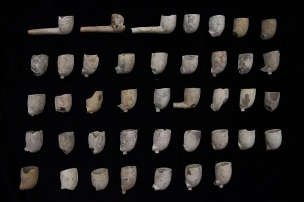
Archaeological monitoring and excavations of road reconstruction in the adjacent neighborhood of Lake Vista (2021) by the City of New Orleans and University of New Orleans, funded by the Federal Emergency Management Agency, excavated windows of past uses of this site. It located glass bottles and household garbage from a fishing camp before the neighborhood’s development in 1930, a shooting gallery related to the Spanish Fort Amusement Park during the 1920s, and at mix of material dredged from the historic fort itself used to fill in low-lying hummocks while the neighborhood was infilled and leveled to its current geography. The artifacts excavated from this site include sherds of decorated Indigenous pottery, faience and majolica and other European colonial ceramic types, and post-twentieth century objects that dated to the area’s use as a resort and amusement park.
Adapted from an exhibit originally published on GNOARCH.com.
Files
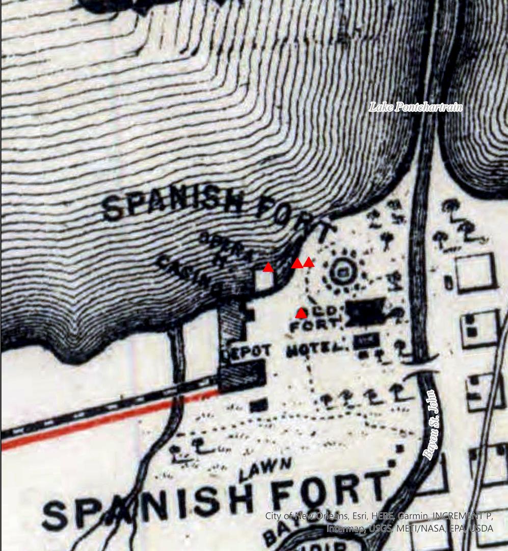
Cotton Centennial Map of New Orleans
Detail of the Cotton Centennial Map of New Orleans (1884) with red markers indicating areas of archaeological excavations. | Source: New York Public Library Digital Collection | Date: 1884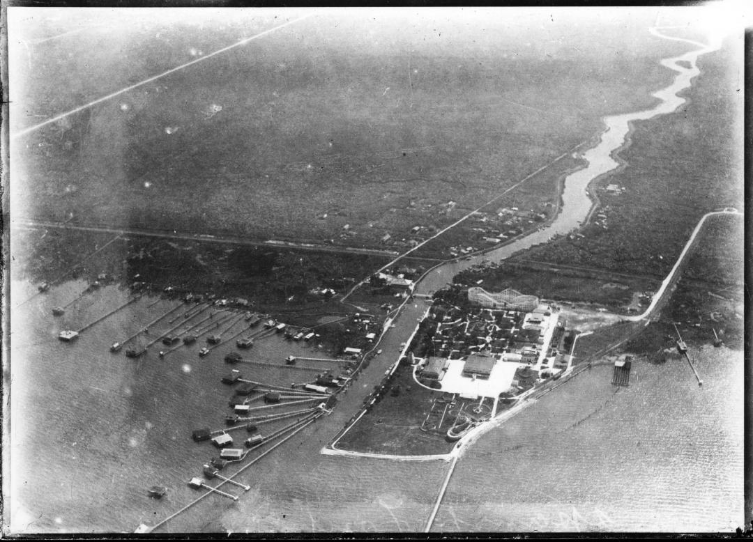
Spanish Fort and Bayou St. John, Aerial View, 1922
Aerial view showing Spanish Fort and Bayou St. John areas as they appeared in 1922. The recently-installed Big Dipper roller coaster (scenic railway) is shown in Spanish Fort Park. | Source: Historic New Orleans Collection, 1979.325.6309. | Date: 1922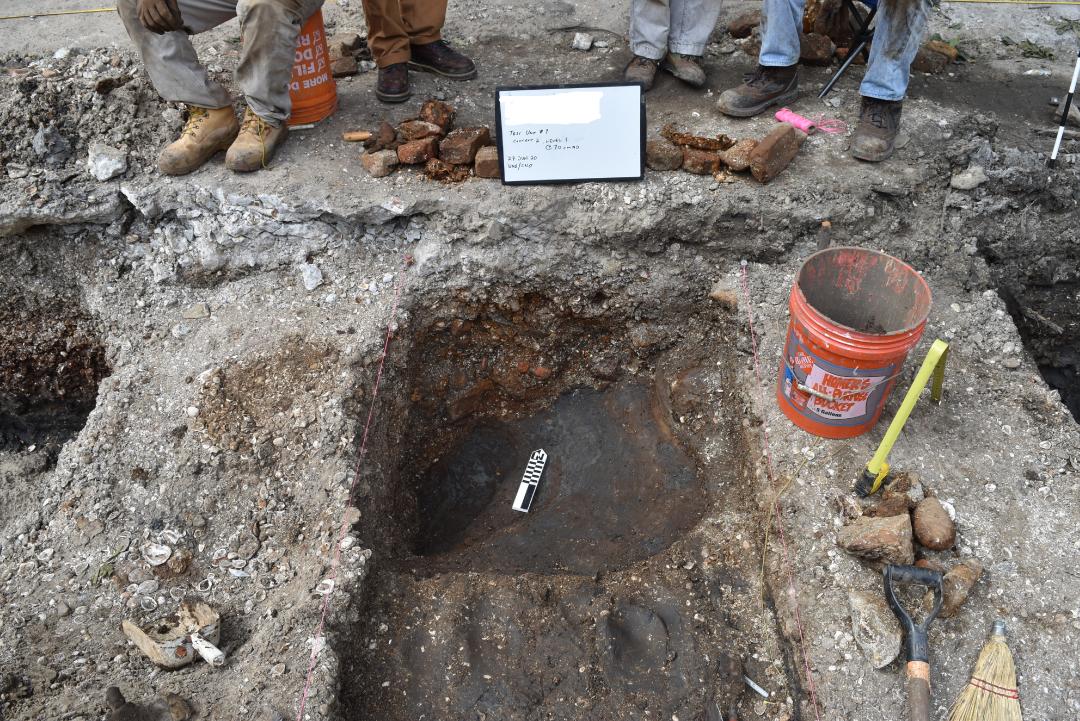
Base of the second shell layer (Context 2) at Killdeer Street
Base of the second shell layer (Context 2) at Killdeer Street | Source: UNO ARC | Date: 2020
Eighteenth Century French-style pottery from Killdeer Street Shell Midden
Eighteenth Century French-style pottery from Killdeer Street Shell Midden | Source: UNO ARC | Date: 2025