Charity Hospital Cemetery No. 2
Text
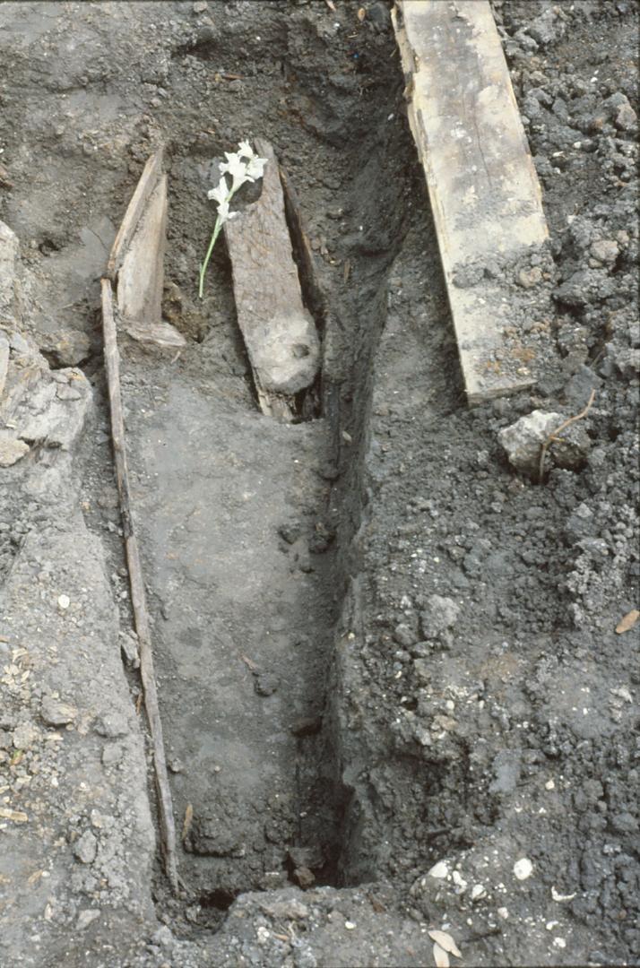
By some estimates, nearly 50,000 burials lie beneath Canal Boulevard, originally Charity Hospital Cemetery No. 2. Almost forgotten since Canal Boulevard's addition to the city's roadways in 1937, road crews rediscovered the cemetery when they added a south-bound lane to Canal Boulevard in the 1980s. They called University of New Orleans to quickly protect the remaining burials with by exhuming approximately 157 burials that would have been damaged by the road expansion had they been left in situ. The land that bound Charity Hospital Cemetery No. 2 was sold to the New Orlean Land Company in 11909, eventually to build Canal Boulevard, completed by 1937. Artifacts collected strewn across the site indicate the land was briefly used or repurposed as a de facto dumping ground; nearly all the bottles collected from above the burials all had scars and manufacture marks that date to the early-twentieth century. Part of the reason that these cemeteries were so clustered together was that the high-ground afforded by the relict distributary system was relatively narrow. Once infrastructure had improved to the point of drainage large tracts of land by the turn of hte twentieth century, private real estate companies were pouncing on the ability to secure profit from previously undevelopable tracts of swamp land like those areas between Metairie Ridge and the south shore of Lake Pontchartrain. The city again modified its underground streetscape along Canal Boulevard in the early 2000s by planning an extension to the Canal Street streetcar. New Orleans Regional Transit Authority (RTA) consulted with a private Cultural Resource Management, Earth Search, Inc. and Louisiana State University's (LSU) Forensic Anthropology and Computer Enhancement Services (FACES) to mitigate the damage by exhuming and processing the burials and human remains from Charity Hospital Cemetery No. 2 that might have been disturbed during the course of this work.
Modified 8/24/2026
Files

Canal Boulevard, prior to excavation
Photograph of the areas to be renovated into new overhead catenary poles for the New Orleans Streetcar | Source: Photograph courtesy of Earth Search, Inc. | Date: 2017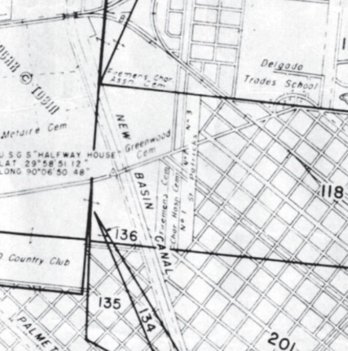
Excerpt of Plat Map T 12 S R 11 E by E. Tobin (n.d.)
The land that bound Charity Hospital Cemetery No. was sold to the New Orleans Land Co. in 1909, eventually to build Canal Boulevard, completed by 1937. | Source: Office of State Lands, Baton Rouge | Date: n.d.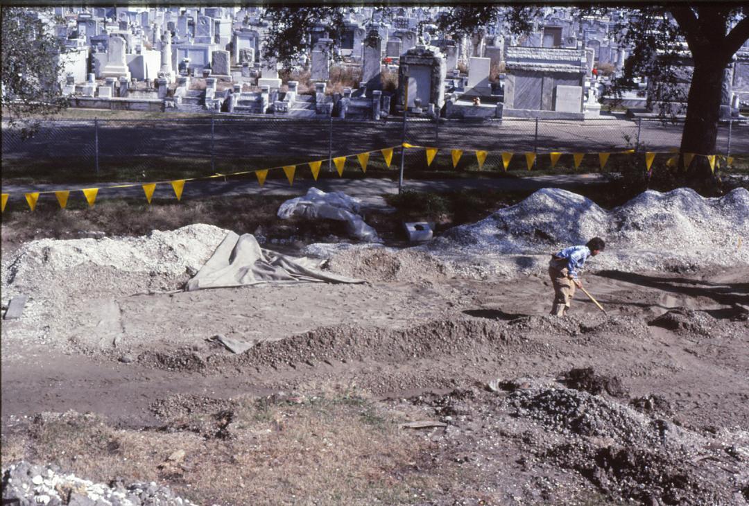
Excavation in Action
A member of the excavation team lies on his stomach as he works on a unit in the South bound lane area. | Source: University of New Orleans Department of Anthropology | Date: 1985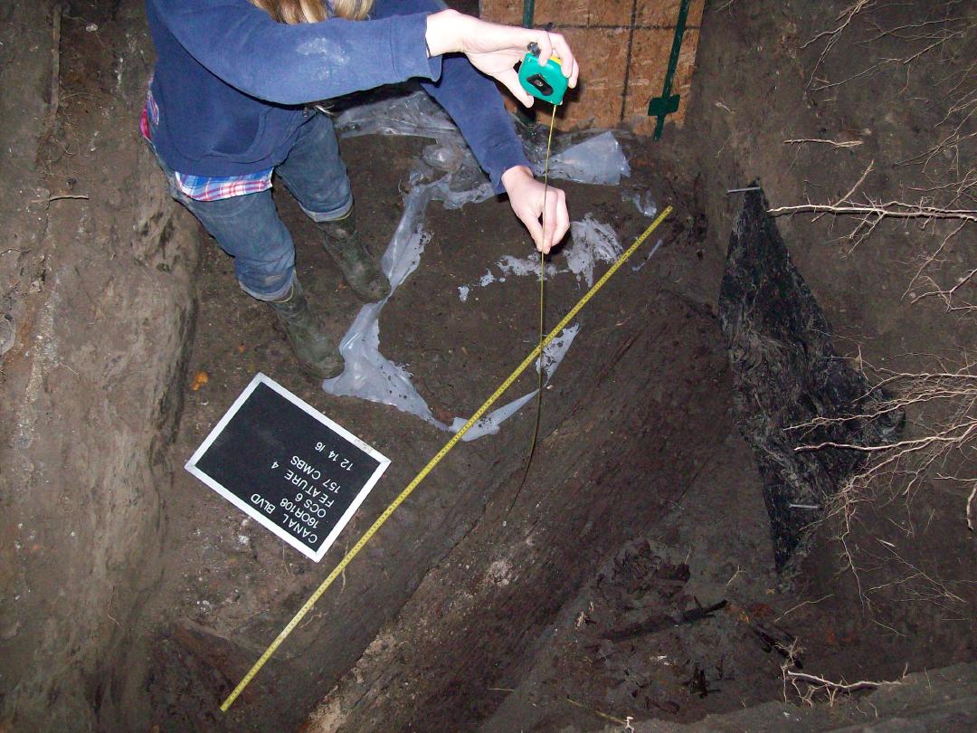
Documenting a burial prior to exhumation
An archaeologist measures the length and depth of a coffin prior to exhumation. | Source: Photograph courtesy of Earth Search, Inc. | Date: 2016