Fire Insurance Maps, Courtesy of New Orleans Public Library.
This file appears in: The Gex Pottery Site at the Lafitte Housing Project
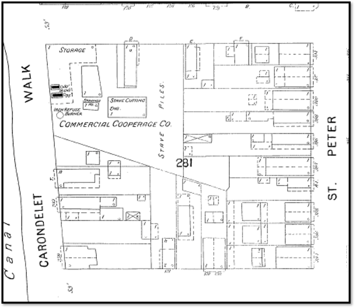
Although no plan was located of the lot during its use a pottery, Sanborn Insurance Maps of the address surveyed in 1893 illustrate the footprint of an industrial furnace when it operated as the “Commercial Cooperage Co.”; the plan includes two iron chimneys, one 50’ and the other 35’ high that would have been the source of a furnace.
This file appears in: The Gex Pottery Site at the Lafitte Housing Project
The Gex Pottery Site at the Lafitte Housing Project
In 2009-2010, archaeologists from ESI excavated the remains of a pottery from one of the blocks during the Lafitte Housing Complex renovation along what used to have been the Carondelet “Old Basin”…