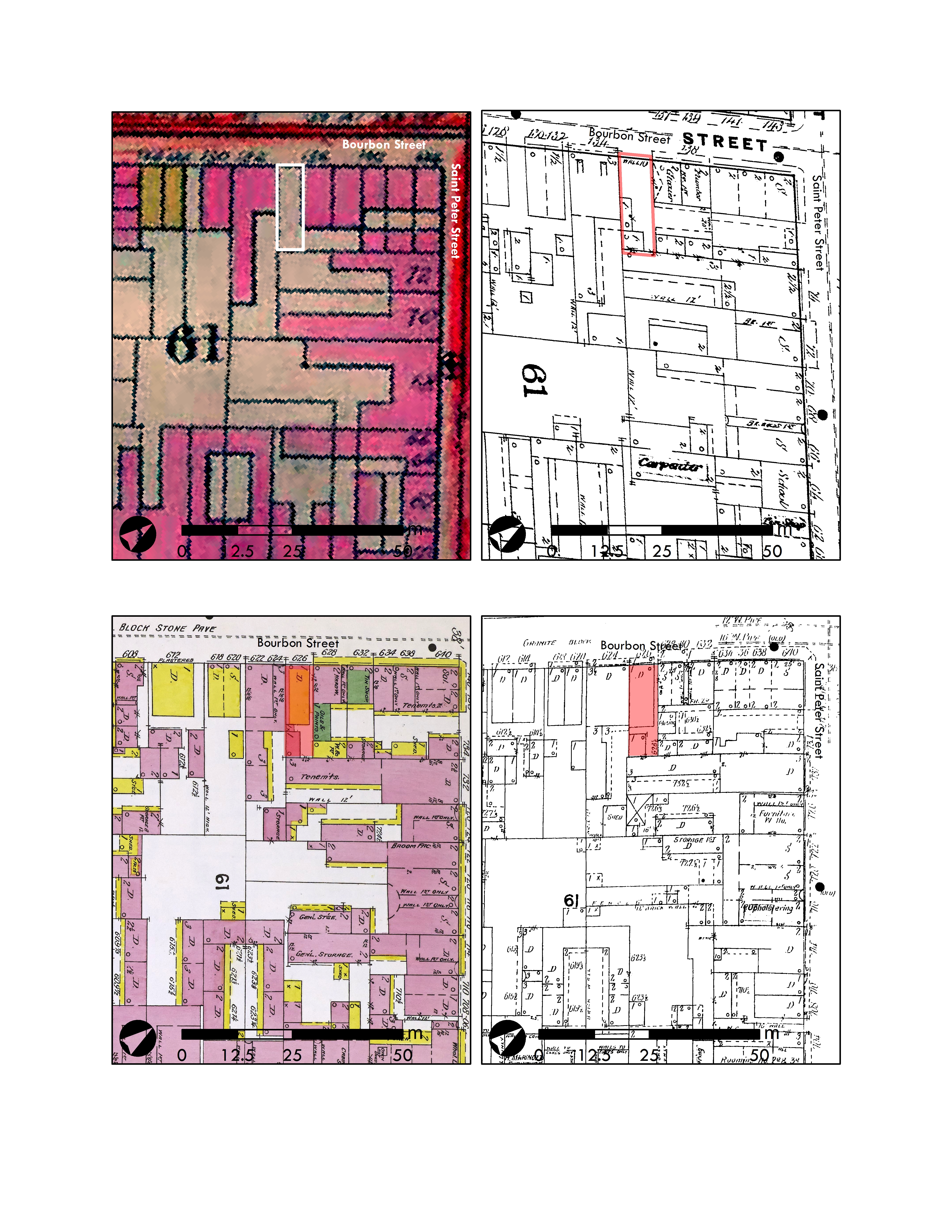
Progression of City Square 61 development, as shown in the Robinson Atlas from 1883 (upper left), the Fire Insurance Map from 1885 (upper right), the Fire Insurance Map from 1896 (lower left), and the Fire Insurance Map from 1908 (lower right).
This file appears in: 626 Bourbon Street
This file appears in: 626 Bourbon Street
626 Bourbon Street
In 2017, Dr. D. Ryan Gray led students and volunteers from University of New Orleans to excavate a portion of a private residence in the French Quarter located at 626 Bourbon Street. The team…